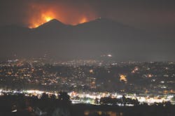
The Holy Fire, a wildfire that began in August 2018, burned approximately 23,000 acres of the Cleveland National Forest in Riverside County, CA. Late summer fires in California are often followed by rain events in the early fall, which, in areas dominated by steep slopes and chaparral, creates favorable conditions for post-fire debris flows, posing risks to communities and structures down-slope from burn areas. The City of Lake Elsinore sits right below the Holy Fire burn area. Local agencies knew rain was likely coming, so preparations had to be made to protect the community.
Protecting the Community
In anticipation of future debris flows from the Holy Fire burn area during storm season, the Riverside County Flood Control and Water Conservation District (District) immediately began efforts to protect the downstream communities, enhance the capacity of District flood control facilities, and prevent sediment and other pollutants from reaching downstream waterbodies, including the Lake Elsinore, a Clean Water Act 303(d) listed impaired waterbody.
Because rain events can follow so quickly on the heels of wildfires in California, Rebekah Guill, a senior flood control planner for the District, says preparations required “all hands on deck.” When it comes to severe post-fire debris flows, she says, “You can’t really stop it, you just have to minimize and stall it in some way.” For the District, that meant looking at what was in its power and its jurisdiction—in this case, debris basins.
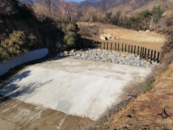
“The crews rapidly began preparations to McVicker Debris Basin and to Leach Canyon Dam,” says Guill. The basins had historical accumulation that needed to be cleaned out and returned to grade. District field crews worked tirelessly at both facilities to increase the storage capacity ahead of the first significant post-fire rain events.
Guill points out that the high to moderate burn severity of the Holy Fire and the chaparral-dominated ecology of the region “create hydrophobic soils that resist water, not allowing it to infiltrate.” As a result, when it does rain, the debris flows can be severe and dangerous. “You end up with thick and viscous discharge that is just pure force at that point,” she says.
Ahead of the first significant rain event, the District assisted with community outreach. “Our staff volunteered, walking around knocking door to door in the most proximate affected communities to make sure people were apprised of the situation and knew that evacuations were coming,” says Guill. “It was important to be connected with people so that they knew what the real risk was.”
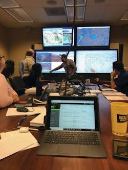
She further explains that “District field crews, planning staff, and finance staff put in long hours to facilitate preparations. Our GIS group prepared and developed evacuation maps and risk maps for use by the County and the City of Lake Elsinore.” The District’s hydrologic data collection group did about a year’s worth of work in a three-month period to install real-time monitoring equipment in areas susceptible to severe post-fire erosion. “People were working from August through November, just working around the clock,” says Guill.
Under more normal circumstances, the debris basins are meant to capture debris as a result of erosion during a natural storm, but during these storms, they were taking on a much larger volume of eroded soils and debris from a burn area. According to Guill, “The debris basins filled up multiple times and District field crews emptied them between rain events.”The accumulated sediment that was removed from District facilities was diverted to local landfills for disposal. Key members of the District’s Watershed Monitoring team, Melissa Varela, Abigail Suter, and Michael Phipps completed the soil sampling necessary to verify that the materials met the waste acceptance criteria of landfills. Under Guill’s supervision, and in coordination with Babcock Laboratories, the team managed to complete expedited sampling, testing, and assessment to ensure that during storm season, the material could be removed as conditions would allow. “The burn area was forestry area; there are no major buildings or infrastructure,” says Guill. Since the material removed was the result of mudslides and burned, organic matter, it was not surprising that the soil testing results met acceptance criteria.
While not all sediment or debris laden flow can be prevented from entering a water body after such a large fire, Guill says the District’s efforts for this event were a success story in terms of the tons of sediment (and associated nutrients and heavy metals) removed from their flood control facilities. Between October 2018 and April 2019, approximately 79,400 cubic yards of material were removed from McVicker Debris Basin. In the same time, about 99,400 cubic yards of material were removed from Leach Canyon Dam.
Preserving Water Quality
“Our mission is to protect life, property, and to protect and preserve water quality,” says Guill. “We have a water conservation attribute as well. Overall, when there is an emergency such as a flood, or in this case a fire, we jump in to assist our neighbors.”
Much of the burned area of the Holy Fire draining to the District facilities eventually reaches Lake Elsinore, a 303(d) listed impaired waterbody with an established Total Maximum Daily Load (TMDL) for nutrients. “Because we knew that the post-fire debris flow could cause a setback to the progress [of the lake], we needed to look closely at the water quality of the discharges,” says Guill. “That’s how the District got involved. What information could we bring to the stakeholders to help them be better informed?”
To that end, the District, developed and implemented a post-fire water quality monitoring study. Guill points out that this was not a compliance-required effort but rather a special study undertaken to assess the potential impacts of the Holy Fire. The goal of the study was to compare the pollutant concentrations in post-fire stormwater runoff from the terminal end of burned catchments to runoff from similar unburned catchments.
For agencies interested in conducting their own post-fire sampling studies, Guill emphasizes care and caution. “When it comes to monitoring, be really thoughtful and cautious about your study design,” she says.
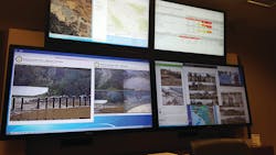
Guill takes safety very seriously. “Safety is first and foremost. As a program manager, I am most interested in my staff coming back from the field,” she says. Guill wasn’t taking any chances. “When we coordinate routine monitoring, each team has to call me every hour on the hour. Storms happen in the middle of the night or the weekend, whenever,” she explains. “But with this storm, we weren’t waiting every hour on the hour. We made more frequent calls to one another, and in between calls we were texting—there was almost constant communication. In some instances, I was even able to drop by our Storm Center and see the consultant team working in the field because of the new real-time video monitoring equipment that had been installed after the fire.”
“If you’re sampling, be cautious,” she advises, and recommends that you have a safe access point for sampling and more than one good exit route. “If you can do it with an automated sampler, try,” she says, although she notes debris flows will likely compromise the monitoring equipment.
The water quality monitoring data revealed higher concentrations of all contaminants—sediment, nutrients, and heavy metals—after both the first and second storm when compared to the reference site, with the highest amounts occurring after the first storm. “What we observed in analytical results was a surge of pollutants coming from this discharge of a forestry burn,” says Guill. She explains that the high concentrations of pollutants from this type of event (natural source of pollution) have the ability to create major setbacks in water quality condition that could completely disrupt the progress being made by municipal stormwater dischargers through their compliance program implementation.
While Guill anticipated that contaminant concentrations in the post-fire discharge would be above average as compared to typical stormwater discharge samples, it was still a bit startling. “I didn’t know it was going to be magnitudes higher. We normally evaluate in units of micrograms per liter, but we saw results in thousands of milligrams per liter,” she says. “I’ve never seen stormwater discharges with these concentrations, and I’ve been in this career for over a decade.”
The data gathered from this water quality study has enabled the District and Lake Elsinore TMDL stakeholders to evaluate the post-fire contribution of pollutant loads in context with other sources within the watershed. This understanding of pollutant concentrations resulting from post-fire runoff will be used to inform future management actions and strategies to protect water quality downstream of future fires. Guill credits her staff and team of consultants. “I really appreciate my team. They’re all amazing professionals. I’m surrounded by people that are so talented, knowledgeable, and eager to be contributing members of this monitoring program.”
The lessons learned from the District’s post-fire response to protect the community and water quality will be used during future emergency planning efforts. “I feel very humbled to be part of the District and to work with these incredible people who stepped outside of their normal day-to-day work to reach out to protect the community,” she says. “On top of the cool science monitoring aspect of it, that part was really amazing to see, and it made me feel proud to be in Riverside County.”
