Introduction
The importance of water and water quality has become a heightened global concern as human populations grow, industrial and agricultural activities expand, impervious surfaces increase, and climate change threatens. The adoption of the federal Clean Water Act and related state and regional environmental regulations imposed on municipal separate storm sewer systems (MS4s), construction sites, and industrial activities necessitated that businesses and agencies pursue and implement water-quality best management practices (BMPs) to curb pollutants in stormwater runoff.
To assist municipalities, developers, and other interested parties with awareness of water-quality impairments and BMP siting and design, Michael Baker International developed iWATR, a free mobile- and Web-based integrated Watershed Assessment Tool for Restoration (www.iWATR.com).
iWATR is the first readily available national engineering tool focused on improving water quality, and it can be used online via a desktop computer, or with the iWATR iPhone app, available in the iTunes App Store.
iWATR combines a Google Maps interface with watershed impairment and national BMP data to instantly produce water-quality and BMP sizing information. iWATR strategically draws information from the US Geological Survey (USGS), Environmental Systems Research Institute (ESRI), US Environmental Protection Agency (EPA), and Natural Resources Conservation Service (NRCS) to obtain annual pollutant discharge, receiving water risk assessments, BMP footprint, cost, and watershed-wide restoration options. For user convenience and privacy, iWATR does not require any sensitive data or prior knowledge about the project. The iWATR process has been successfully used for multiple projects in California, including harvest and use modeling, BMP retrofit siting and prioritization, and pollutant load reduction studies.
Overview
Application Interface. iWATR generates a planning-level estimate that allows the user to quickly view the watershed contaminants and compare the feasibility of various locations and BMPs, such as the bioretention basin shown in Figure 1. Accessing the iWATR website and mobile app, users can select any location in the United States, as shown in Figure 2. The watershed name and boundary display for the selected location. Yellow caution signs indicate 303(d)-impaired water bodies, which can receive a designated maximum amount of a pollutant of concern while still meeting water-quality standards. The user then selects the project acreage and one of four types of land uses—residential, commercial/industrial, roadway/parking lot, or institutional/school—along with the pollution risk for certain contaminants, such as metals, nutrients, pathogens, and sediment. Based on the site characteristics, including soil type, depth to groundwater, and site acreage, feasible structural BMP options are presented, and the user can contrast the estimated costs for construction, operation, and maintenance, along with the design footprints of up to eight types of treatment BMPs: bioretention/rain gardens, media filters, vegetated strips/swales, underground infiltration, infiltration basins, extended detention basins, wet ponds, and permeable pavement.

Figure 2. BMP retrofit and water conservation opportunities
If stormwater harvest and use is feasible at the site, a water droplet icon displays on the map, which the user can click to show an estimated tank volume and annual irrigation savings. BMP retrofit opportunities can be displayed by checking the box for watershed-wide restoration options. Each BMP retrofit option is a public park and is displayed as a green tree on the map, which the user can click to show the retrofit location name, approximate footprint, and estimated retrofit credit in acres (Figure 3).

Figure 3. Report of results
iWATR Water-Quality Process. The iWATR process (Figure 4) uses an approach of data organization and analysis that is used in the website application, the mobile apps, and the projects described in the case studies. The case studies differ in their scope and additional criteria and steps required by the specific projects.

Figure 4. iWATR process
The iWATR water-quality process takes place in two steps: GIS Watershed Analysis and BMP Prioritization and Assessment. In step 1, the GIS Watershed Analysis Tool identifies potential BMP sites and potentially feasible BMPs. In step 2, BMP Assessment and Prioritization, the iWATR application generates engineering estimates of BMP sizing and cost data. In projects, including the case studies in this article, the BMP Assessment and Prioritization step consists of field verification and engineering design by project engineers.
In the watershed analysis step, iWATR presents watershed data, including pollutant information and design constraints, to identify the recommended BMP for the selected site and provide initial sizing estimates.
Model input data comprises the following types of information:
- EPA 303(d) list of impaired and threatened waters
- Digital elevation model (DEM) from USGS for tributary drainage area determination
- USGS National Hydrography Dataset (NHD): A digital database of surface water features on maps and stream gages for the US
- USGS precipitation data: Hourly records from more than 14,000 stations throughout the US
- Land use: Used to identify the percent of impervious cover in the tributary drainage area
- Soil type: Average soil type in tributary drainage area, based on the NRCS Soil Survey Geographic (SSURGO) database
- SSURGO database runoff coefficient: Average runoff coefficient for the tributary drainage area, calculated as a function of soil type and percent impervious area
- Groundwater depth: Maximum depth to the seasonably high water table (NRCS)
- Area available for retrofit BMP: ESRI parks data
- Watershed: Major watershed in which the potential site is located
The feasibility of each BMP type at a site is determined by the ability of the BMP to treat the pollutants of concern in the receiving water and the technical feasibility of implementing the BMP at the location. For all BMPs, the available area for the BMP footprint must be sufficient to treat the water-quality volume, a precipitation volume determined by regulatory agencies and local climate. The iWATR mobile and website applications use a water-quality volume derived from the mean storm precipitation volume, defined as a six-hour inter-event period and computed at more than 14,000 meteorological stations across the US. For case studies, the location-specific regulatory water-quality volume is used. Considerations include:
- Location constraints: Location feasibility concerns for infiltration BMPs include depth to groundwater and soil infiltration rate.
- Drainage area size: Drainage tributary area size is determined by identifying flow paths with an ESRI model that couples DEMs and water bodies identified by the NHD dataset.
- Receiving water impairments: The water-quality volume for the drainage area is compared to the treatment capacity of the potential BMP at the site. BMPs that would be ineffective in removing the 303(d) pollutants of concern in the receiving waters at the site are deemed infeasible.
In addition, the iWATR app determines harvest and use feasibility based the estimated irrigation need and average annual precipitation at the selected site. Irrigation need is estimated based on the land use and perviousness of the selected site.
In projects such as the case studies below, the iWATR BMP Prioritization and Assessment step uses the data from the GIS Watershed Analysis Tool to identify BMP types and locations that could maximize the water-quality benefits for the implementation cost. First, each potential BMP site is field verified by Michael Baker International engineers. Field data are used to confirm the GIS model evaluation and identify any additional site constraints. Final BMPs for each site are selected based on information from the GIS Watershed Analysis Tool, the identified pollutants of concern for the watershed, and information collected as part of the field verifications. When a number of different BMPs have been identified as suitable for a site, the potential benefits to receiving water quality are the deciding factor based on the estimated removal efficiencies of the potential BMPs. Water-quality benefits can be quantified by comparing pollutant influent concentrations to each identified retrofit BMP with the expected effluent concentration from the International Stormwater BMP Database. Engineering design, construction, and cost are then determined by the Michael Baker International engineering team.
In the iWATR mobile and Web applications, the BMP Prioritization and Assessment step consists of planning-level information covering BMP sizing, cost, and watershed-wide retrofit BMP opportunities. The iWATR app uses data from the GIS Watershed Analysis Tool to provide planning-level BMP sizing and cost data. BMP sizing data is based on the Maximized Water Quality Capture Volume methodology (WEF 1998). Cost data include capital and operation and maintenance costs (not including land acquisition) and are estimated based on the calculated BMP footprint and literature for each BMP’s capital and operation and maintenance costs. The app displays all BMP retrofit opportunities for the user-selected watershed. Potential retrofit BMP sites are based on ESRI parks data within the United States. The optimal retrofit BMP type for the site is determined by the GIS Watershed Analysis tool.
The iWATR process has been used in projects for BMP retrofits, stormwater harvest and use, and pollutant load reduction throughout California. Two notable projects are the Orange County BMP Retrofit Opportunities Study and the San Bernardino County Watershed Action Plan.
Case Study 1: Orange County BMP Retrofit Opportunities Study
A retrofit BMP siting and prioritization approach was developed for the Orange County Municipal Stormwater Program to aid in future watershed-wide planning processes.
Background. In 1993, the Orange County Municipal Stormwater Program developed a Drainage Area Management Plan (DAMP) to reduce pollutant discharge within the county to comply with federal water-quality regulations. DAMP treatment oriented programs use baseline water-quality monitoring data to identify areas that need additional treatment from retrofit BMPs. County permittees commissioned a BMP Retrofitting Opportunities Study aimed at developing a logical approach to identify and prioritize potential BMP retrofit opportunities for watershed planning. The iWATR process was used to identify and prioritize potential BMP retrofit opportunities within the permit area and develop a method for future watershed BMP evaluation.
Technical Approach. Project steps consisted of the following:
- Development of retrofit BMP site-selection criteria
- GIS model development
- Identification of sites
- Identification of pollutants of concern
- Initial BMP selection
- Field verification of model-selected BMPs sites
- Final BMP selection
- Conceptual design
- Water-quality modeling
- BMP prioritization
Site-Selection Criteria. Site-selection criteria were formulated to develop an initial list of all feasible treatment BMP sites. Potential retrofit locations had to fulfill the following requirements:
- Serve a drainage area of 50 to 500 acres to take advantage of the benefits of regional treatment facilities. Regional facilities require less right-of-way land purchase and less maintenance and have other benefits compared to multiple smaller BMPs.
- Decrease land purchase costs by locating sites near drainage facilities and near available publicly owned land
- External drivers that can affect BMP selection
- Compliance with all regulatory requirements
GIS Model Development. The study used the iWATR process to create a database with information about runoff volume, pollutants of concern, and BMP siting opportunities. A digital elevation model and digital orthophotography were used to delineate stream networks. Land-use information was obtained as a zoning overlay to identify publicly owned and undeveloped parcels.
Identification of Sites. To determine potential BMP retrofit locations, Michael Baker and the county developed the drainage network, identified drainage catchment areas and potential retrofit sites, and characterized the site tributary area. ArcView and a DEM of the area were used to model major drainage paths and identify sites serving 50 to 500 acres. Tributary areas of interest were overlaid with layers of aerial photography, public parks, drainage facilities, and any environmental jurisdictional boundaries. Potential sites were selected based on proximity to receiving waters, locations of publicly owned land, and where there appeared to be sufficient space for a regional BMP.
Identification of Pollutants of Concern. Pollutants of concern were identified for each potential BMP site based on the 303(d) listing for the watershed encompassing the site.
Initial BMP Selection. The BMP selection process utilized the iWATR process and took place in two steps. The first step involved using the GIS model and site-specific constraints to reduce the number of BMPs under consideration to those that are technically feasible for the conditions at potential sites. A database was developed to contain information for the identified sub-watershed/site such as water-quality volume, space available for installation, hydraulic head available, water table elevation (estimate), soil type, aesthetic needs, vector concerns, maintenance, and maintenance access requirements. In the second step, BMPs were selected based on physical compatibility with the site and ability to address the pollutants of concern for the watershed. Potential BMPs were ranked according to relative life-cycle cost.
Field Verification of Model-Selected BMP Sites. The list of potential BMPs identified by the GIS model was refined through field verification to identify site constraints that may preclude specific BMPs. Typical constraints include BMP footprint, soil types, hydraulic head, and adjacent land uses.
Final BMP Selection. The final BMPs for each site were selected based on information from the GIS model, constraints identified in the initial BMP selection, the identified pollutants of concern for the watershed, and information collected as part of the field verifications. When a number of different BMPs were identified as suitable for a site, the potential benefits to receiving water quality were the deciding factor based on the estimated removal efficiencies of the BMPs being considered.
Conceptual Design. A concept level drawing in MicroStation was prepared for potential BMP sites. The objectives of the concept design were to develop a unit price cost estimate for budget purposes and an initial BMP configuration for each site.
Water-Quality Modeling. Potential water-quality benefits of the identified retrofit BMP opportunities were also quantified to add to the retrofit BMP prioritization process. Hydrologic Simulation Program–Fortran (HSPF) watershed models were developed to quantify potential pollution reduction for representative watersheds. Watersheds contributing runoff to each potential BMP site were identified and used to determine influent characteristics such as impervious area and pollutant loading.
For the Aliso Creek Watershed (shown in Figure 5), modeling was performed with varying numbers of the identified retrofit BMP opportunities as different implementation scenarios. Modeling showed that implementation of all BMPs identified in the Aliso Creek watershed would achieve a 25% reduction in nitrate released to the receiving water. Implementing only one BMP in a key location would result in a 10% decrease in nitrate. The model showed that the proposed retrofit BMPs would be effective in improving received water quality.

Figure 5. Aliso Creek watershed potential retrofit BMP sites. Source: 2010 Orange County Stormwater Program Identification of Regional BMP Retrofitting Opportunities Phase III Report
BMP Prioritization. Sites that met all selection criteria were prioritized to provide a planning framework for regional BMP implementation for Orange County. Preference was given to sites with higher-density upstream land use, larger tributary areas, and the most space available for BMP implementation. These categories were intended to identify the retrofit opportunities with the highest potential benefit to the permit area as a whole while providing quantifiable inputs for the model. BMP construction, operations, and maintenance cost were calculated and ranked for each retrofit site.
Orange County BMP Retrofit Opportunities Study Results. More than 200 potential BMP retrofit sites were identified in the initial BMP feasibility assessment, 23 of which were selected as high priority after the prioritization review process. The 23 potential sites can provide treatment for approximately 5,700 acres of tributary area, or roughly 2% of the urbanized area within Orange County. Potential BMP locations are shown in Figure 6. The proposed retrofit BMP locations were supported by water-quality modeling that showed the effectiveness in improving receiving water quality.

Figure 6. Potential BMP retrofit site locations. Source: 2010 Orange County Stormwater Program Identification of Regional BMP Retrofitting Opportunities Phase III Report
Case Study 2: San Bernardino County WAP BMP Retrofit Study
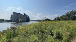
The San Bernardino County MS4 Permit for the Santa Ana Region requires the County of San Bernardino, the San Bernardino County Flood Control District, and the incorporated cities of San Bernardino in the Santa Ana Region to develop and maintain a watershed action plan (WAP). Phase I of the WAP required a system-wide evaluation to identify water-quality retrofit opportunities in stormwater conveyance systems, parks, and other recreational areas. In Phase II of the WAP, the BMP retrofit opportunities were ranked to compare each potential retrofit site for effectiveness in mitigating adopted total maximum daily loads (TMDLs), hydrologic conditions of concern, and the opportunity for the retrofit sites to serve as low-impact-development (LID) offset projects. Figure 7 shows the Middle Santa Ana River watershed in San Bernardino County.

Figure 7. Middle Santa Ana River watershed in San Bernardino County. Source: 2014 San Bernardino County Watershed Action Plan
Technical Approach. The iWATR process identified 144 potential BMP retrofit sites. Each BMP retrofit location was then considered for three separate goals: meeting the requirements for TMDLs, mitigating hydromodification impacts, and potentially serving as LID offset projects. The three criteria were weighted to give a composite prioritization rank to each retrofit site to demonstrate the capability of each in contributing to the county’s water-quality goals.
TMDL Compliance. The TMDL retrofit analysis focused on quantifying reductions in pollutant load and effluent concentration in the implementation of each retrofit site for the approved TMDLs in the Santa Ana region of San Bernardino County, including the Middle Santa Ana River Bacterial Indicator TMDL for dry-weather conditions, the Middle Santa Ana River Bacterial Indicator TMDL for wet-weather conditions, and the Big Bear Nutrient TMDL for dry hydrological conditions focused on phosphorus.
The iWATR process was used to quantify each site’s pollutant removal potential through calculation of influent and effluent pollutant loadings and concentrations identifying the benefit of each of the potential locations for helping to meet the TMDL requirements. Infiltration-based BMPs were identified as the most effective for all three TMDLs. E. coli removal was best achieved by infiltration BMPs due to their ability to reduce dry-weather flows. Fecal coliform loading was reduced by both infiltration-based BMPs and wet ponds, with other BMPs providing negligible mitigation. Phosphorus loading to Big Bear Lake was shown to be mitigated only by infiltration-based BMPs, though other structural BMPs that reduce sediment loading could indirectly reduce nutrient loading of sorbed nutrients.
Hydromodification Management. The hydromodification study assessed the ability of each BMP retrofit site to reduce the effects of hydromodification in the permitted area of the watershed. The study evaluated each BMP’s capacity to infiltrate stormwater onsite, identified the imperviousness of the drainage area tributary to the retrofit site, and quantified the additional imperviousness in the drainage area that the retrofit BMP could offset through volumetric mitigation.
BMP retrofit sites were evaluated for their potential to mitigate hydrologic conditions of concern (HCOC) by comparing pre- and post-development hydrology to fulfill the permit requirement that “Post-development runoff volume, time of concentration, and peak flow velocity for the two-year frequency storm must not exceed that of the predevelopment condition by more than five percent” (Section XI.E.5d of the Permit).
For this planning-level analysis, volumetric mitigation was quantified for each potential BMP retrofit site by comparing the two-year flow produced under existing (current) imperviousness, and an assumed developed condition with runoff volume equal to the maximum allowed 105% of the existing condition. For tributary areas with potential infiltration BMP opportunities, the maximum flow for full build-out conditions in the drainage area was identified. The volume potentially mitigated by infiltration BMPs was represented as the future impervious development area that could be offset. If all potential infiltration BMPs were implemented, approximately 15,792 acres of future development area would be offset.
LID Offset. Each identified BMP retrofit site was evaluated for feasibility as an offset project for development projects required to implement LID onsite. During this phase, infiltration and harvest and use opportunities were identified and quantified for the 24-hour, 85th percentile water-quality design storm.
Two separate methodologies were applied to evaluate
- The amount of impervious area that may be offset through infiltration
- The feasibility of using the retrofit site as a harvest and use site
The available BMP footprint area and an assumed infiltration depth were used to calculate the BMP’s design capture volume, which is the volume required by development sites as identified in the LID requirements in the permit. The volume potentially mitigated by infiltration BMPs was represented as future impervious area that could be offset.
Harvest and use feasibility requires both sufficient precipitation to offset storage costs and sufficient nearby demand for reuse water. Per the San Bernardino County Technical Guidance manual, if the landscape near the BMP project site had a wet season demand of less than 50% of the water-quality design capture volume over a 48-hour period, harvest and use was deemed as infeasible for the site. Additionally, harvest and use opportunities had to be within 1,000 feet of a park, sports field, golf course, or agricultural area to meet demand feasibility criteria. In total, the potential LID infiltration BMPs offset approximately 5,020 acres of impervious area. Harvest and use was determined to be feasible at 36 sites.
BMP Retrofit Prioritization. One of the objectives of the retrofit study was to classify the retrofit sites based on the cost effectiveness to provide water-quality benefits. This classification process is imbedded into the iWATR platform and is based on the development of a benefit score (high, medium, and low). The overall benefit score comprised four separate scores defined by
- The cost effectiveness toward LID offset through infiltration (30%)—ratio of impervious area offset to estimated capital cost
- The cost effectiveness toward hydromodification mitigation (30%)—ratio of impervious area offset to estimated capital cost
- The cost effectiveness toward TMDL compliance (30%)—ratio of the annual load reduction of E. coli in dry-weather runoff to the estimated capital cost
- The feasibility of harvest and use (10%)
Scorecards with the prioritization criteria were developed for each BMP site (Figure 8).

Figure 8. BMP retrofit prioritization scorecard. Source: 2014 San Bernardino County Watershed Action Plan
San Bernardino County Watershed Action Plan BMP Retrofit Study Results. Phase I of the WAP identified 144 potential retrofit opportunities. Each potential retrofit site was considered for its ability to remove address TMDL requirements, mitigate hydromodification impacts, and potentially serve as LID offset projects. Based on additional information for each of the potential BMP retrofit sites, including input from the county, flood control district, and the cities in the Santa Ana Region of San Bernardino County, 72 sites were evaluated in Phase II of the WAP. Fifty of the 72 sites evaluated in Phase II were identified as “high value” for meeting watershed water-quality goals.
Conclusions
iWATR performs a unique service for MS4 agencies, planners, developers, and any other interested parties as an educational, planning, and conceptual engineering tool for water quality. It is both an application that instantly provides water-quality data and engineering estimates, and a complex model that can be customized for specific study areas. In an ever-increasing regulatory environment with growing water-quality concerns, digital tools such as iWATR can provide the data and engineering approaches necessary to work toward the goals outlined in the Clean Water Act: fishable and swimmable water for all.
References
Michael Baker International. 2016. iWATR. www.iWATR.com, also available in the iTunes App Store and Google Play.
Orange County Municipal Stormwater Program. 2010. Identification of Regional BMP Retrofitting Opportunities Phase III Report.
San Bernardino County. 2014. San Bernardino County Watershed Action Plan. www.waterboards.ca.gov/santaana/water_issues/programs/stormwater/san_bernardino_permit_wap.shtml.
Water Environment Federation. 1998. Manual of Practice 23, Design of Urban Stormwater Controls.