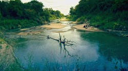
Even as agencies around the nation adjust operations in the face of the COVID-19 pandemic, US Geological Survey (USGS) crews are still measuring flooding across the country, as spring weather is in full swing. Warming temperatures, increased precipitation, and snowmelt have caused moderate to major flooding in the upper Midwest, East Coast, Central Plains, and the Southeast portions of the country.
What the USGS is Doing
Crews are in the field to keep the USGS’s stream gauge network of about 11,300 instruments working properly, perform on-site measurements of flooded rivers, and measure high-water marks as floodwaters recede.
In the coming days and weeks, USGS crews will continue to monitor stream gauges, make flood measurements in the field to determine how much water is flowing, and provide other data used for flood forecasting and flood-control reservoir management.
Flood Information is Critical to Public Safety
The data from the USGS’s nationwide stream gauge network provides vital information to the US Army Corps of Engineers, the National Weather Service, and other federal, state, and local agencies, enabling them to make river forecasts, operate flood control structures, and make important emergency management decisions. Frequent measurements are needed during flooding to document possible changes in a stream’s channel, which could affect river levels.
Responding during COVID-19
The response to spring flooding is complicated this year by COVID-19. The USGS is working to provide flood information that is critical to public safety while also keeping employee safety and well-being a priority.
"Our field crews are working long days to help provide critical streamflow information for flood forecasting," said USGS National Flood Hazard Coordinator Karl Winters. "Despite the challenges associated with COVID-19, our field crews have made nearly 800 streamflow measurements per week over the last six weeks."
USGS water science centers are thoroughly evaluating needs for streamflow measurements and prioritizing stream gauges most useful to flood forecasting and management.
Field crew partners are traveling to stream gauge sites in separate vehicles, often with single-person crews, wearing appropriate personal protective equipment, and practicing social distancing. Overnight trips are limited, so crews are often working longer days to make round-trip visits to sites. Crews are also leveraging the many tools made available to work from home and remotely meet with others when possible.
Despite the recent challenges, USGS crews made more than 20,000 streamflow measurements nationwide between January 1 and April 20, 2020.
Looking Towards the Future
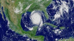
As some states hit by severe weather begin to return to normal, others are preparing for what’s to come or dealing with continued flooding and the dangers that come with it. As snowpack is expected to continue to melt across the West and hurricane season begins on June 1, the USGS will continue to monitor stream conditions and use data collected to prepare for current and future flood events.
For up-to-date info on conditions in your area, visit the USGS WaterWatch website.
Source: USGS
Click here for Stormwater's ongoing coverage of COVID-19