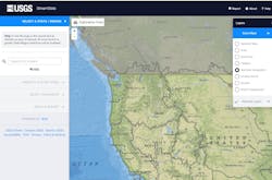
October 10, 2019 — The Lake of the Woods-Rainy River Basin watershed forms part of the international boundary between the American state of Minnesota and the Canadian provinces of Manitoba and Ontario. There are unique challenges to the control and management of a binational watershed. The US Geological Survey (USGS) has developed a method that will support its popular StreamStats application for the first time in a watershed shared by two countries.
StreamStats is a web-based geographic information system tool developed by USGS. StreamStats allows users to obtain streamflow statistics, basin characteristics, and other information for user-selected locations on streams through an interactive map.
The ability to use StreamStats in the Lake of the Woods-Rainy River Basin is one practical result of work to harmonize hydrographic data between agencies in Canada and the US that has been facilitated by the International Joint Commission (IJC). The IJC prevents and resolves disputes around the use and quality of boundary waters in the US and Canada and acts as an objective advisor to both governments.
The binational study updated statistical equations that are used to estimate the magnitude and frequency of peak flows on streams in Manitoba, Ontario, and Minnesota within the Lake of the Woods–Rainy River Basin.
The effort represents a significant milestone in addressing binational water management objectives and providing timely information to practitioners on both sides of the border for sound planning and monitoring activities. Hydraulic engineers use peak streamflow data to inform designs of bridges, culverts, and dams, and water managers use peak streamflow data to inform regulation and planning activities.
The study will contribute to future international water management efforts, including models used to assess water quality impacts and regulate water levels in the basin. The results have pushed the yardstick further in pursuit of binational scientific collaboration.
The binational study was conducted by the USGS in cooperation with the International Joint Commission and the Minnesota Department of Transportation. Environment and Climate Change Canada and the Ontario Ministry of Natural Resources and Forestry provided support for the project and assisted with the collection of streamflow data in Canada.
All equations presented in the study have been incorporated into StreamStats.
Study results have been published in the report "Techniques for Estimating the Magnitude and Frequency of Peak Flows on Small Streams in the Binational U.S. and Canadian Lake of the Woods–Rainy River Basin Upstream from Kenora, Ontario, Canada, Based on Data through Water Year 2013."


