The City of Salinas, with a population of more than 150,000 in the agricultural heartland of California, has revamped the way it manages stormwater, implementing an efficient, data-driven program. In the process, it has become a leader in demonstrating compliance with NPDES regulations.
The City was driven by two main challenges. First, managing silos of information, including inspection records and other studies that needed to be provided to regulatory authorities annually, was inefficient. Traditionally, city staff spent months each year producing annual reports over 2,800 pages long—an extremely time consuming and expensive task. The reports themselves were dense compilations of lists, tables, and check boxes but, ultimately, were not very useful to inform decisions or convey regulatory compliance. The City wanted a more efficient way to collect and track and report to its regulatory authority.
Second, the City lacked a way to track the impact of stormwater investments per National Pollutant Discharge Elimination System (NPDES) regulations. NPDES regulations stem from the Clean Water Act and apply to nearly every city and county in the US. The intent of the regulations is to reduce the impacts of urbanized lands on local waterways. As a result, cities and their residents spend millions implementing green infrastructure, street sweeping programs, litter cleanup efforts, and other practices. Regulators increasingly require cities to quantify, track, and demonstrate the impacts of their actions on reducing pollutants. With the cost of stormwater programs expected to increase significantly over the next 20 years, the City of Salinas needed a way to document and communicate the effectiveness of its planned and implemented stormwater investments aimed at reducing urban runoff and pollutant (including trash) delivery to local waterways.
To address these challenges, the City of Salinas needed a way to leverage readily available GIS datasets and to modernize how it tracked and reported program compliance and associated benefits to regulators, city leadership, and the community. The City chose to use 2NFORM, an off-the-shelf solution created by 2NDNATURE that requires no GIS experience or coding ability.
Conceived and developed by scientists, the 2NFORM software provides the city with a standardized stormwater solution for regulatory compliance. It aids city staff in collecting and managing required information more efficiently and uses that data to quantify the environmental benefit of program assets and actions.
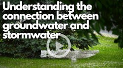
Location Is Understanding
Effectively managing stormwater requires solutions that reduce runoff and urban pollutant delivery to local waterways. Moving to a GIS-based geospatial data management system has allowed the City of Salinas to more efficiently manage its assets and track the effectiveness of the stormwater program.
Within the 2NFORM system, the assessor’s parcels layer and road networks make up the foundation of the City’s data management system. The landscape is grouped into urban catchments and linked to the waterways into which they drain. 2NFORM digests the city’s ArcGIS system of record asset locations and specifications that include urban outfalls, catch basins, dry basins, treatment vaults, bioretention systems, and other private and public stormwater assets.
2NDNATURE’s purpose-built rapid assessments (2N RAM) are available to city field personnel on mobile applications made available on Esri Collector and Survey123 platforms to streamline inspections of public and private BMPs within the City. These customized rapid assessment methods empower nontechnical field staff to objectively generate consistent results efficiently and precisely. One of the 2N RAM inspection results informs structural BMP maintenance urgency. Unmaintained BMPs are captured in these analyses. The performance of BMPs within each urban catchment is quantified and expressed as the acre-feet of stormwater runoff or tons of pollutants annually that are reduced to the local waterway. These metrics are purposely sensitive to the stormwater program actions and not to interannual climatic variability. Automated advanced analytics provide the City with mapped and graphical summaries of spatial patterns and temporal trends of reduced stormwater runoff and pollutant delivery to receiving waters year after year.
Effective structural and nonstructural controls to eliminate urban trash delivery to receiving waters are tracked using similar mobile data collection and advanced analytical techniques. Data collection is more efficient and transformed into information to guide urban trash control program adaptation over time. If EPA deems a waterway impaired, the City can track and report its progress in improving the waterway in a quantifiable and scientifically defensible way.

Beyond pollutant load reductions, 2NFORM builds efficiency throughout the City stormwater program by tracking records by location. Information and inspections for active construction projects or commercial property best housekeeping records can be mapped to quickly communicate inspection workflows, phase, violation status, or other information. Tracking records are compiled into automated summaries to document program activities across departments and (at the end of each year) to the regulatory authority. With the gained efficiency, the City can allocate more resources into cleaning up the urban landscape, and with it, urban stormwater.
The MS4 Permit Reporting Hub
The City is working toward full submission of its annual reports to regulators through the 2NFORM reporting hub. The regulatory authority is granted read-only access to locked annual data records through which it can evaluate the City’s annual compliance. This feature is slowly eliminating the voluminous static annual report. Having mutually agreed-upon data fields and reporting summaries with the regulator reduces compliance uncertainty for the City. With regulatory staff reviewing dozens of municipal annual reports, the 2NFORM information hub also makes regulatory staff more efficient and improves their ability to communicate expectations with permittees.
With more efficiency and better communication, the City of Salinas can focus its limited resources on implementing the most effective actions in the most urgent locations. Ultimately, the changes will allow Salinas to reduce the hydrologic and pollutant impacts its stormwater has on the local waterways.