Waves of colorful sea creatures and mermaids flooded the Coney Island Boardwalk in Brooklyn, NY, this summer for the annual Mermaid Parade. Just months earlier, in the very same spot, Hurricane Sandy with her massive waves stormed ashore-but not in such a festive mood.
After the storm retreated, leaving the beach a mess, it seemed the parade-which draws thousands of costumed participants each year-would not return. But the mermaids did and showed tremendous community support in an event that’s ironically a celebration of the sea.
One of the mermaids, who is also a Brooklyn resident, said that during the parade there was talk of how Coney Island has bounced back even stronger, and the resilience and heart of the community is incredible.
The same could be said about the Army Corps of Engineers, New York District, which is overseeing a 60-project, $3 billion initiative to develop long- and short-term risk reduction strategies for coastal communities.
Hurricane Sandy
On October 29, 2012, Hurricane Sandy’s 80-mile-per-hour winds and 30-foot-high waves pounded the eastern coast of the United States. The storm made its way from Florida up to Rhode Island, New York, and New Jersey, all of which were hit especially hard. (New Jersey is within New York District’s area of responsibility.) The surge of seawater inundated coastal communities, flooding roads and transportation systems, damaging electrical facilities, and causing widespread power outages.
Immediately after the storm, the Army Corps was on the ground responding, both through its own response authorities and also by providing disaster response assistance for the Federal Emergency Management Agency (FEMA). Army Corps-trained response teams from around the nation came to the region to assist the New York District in unwatering subway tunnels, providing temporary emergency electrical power to critical facilities, removing tons of debris, and closing barrier island breaches. Sandy is also responsible for 60 deaths, $19 billion in damages and millions of cubic yards of sand removed from miles of coast. This sand loss makes coastal communities extremely vulnerable to future storms.
In January 2013, Congress signed the Hurricane Sandy Disaster Relief Appropriations Act of 2013, or the “Sandy Bill,” giving the Army Corps funding and authority to take steps to restore coastal projects and navigation channels affected by Sandy and reduce risk from storms to coastal communities in the northeastern US.
The Army Corps is carrying out this mission in several steps that are being performed simultaneously. Right now, districts in the northeast are repairing and restoring previously constructed coastal projects affected by Sandy. These include the replacement of lost sand on beaches. The Army Corps is also progressing on projects and studies that were underway before Sandy. In addition, its North Atlantic Division, of which the New York District is a part, is working on the North Atlantic Coast Comprehensive Study, which will provide strategies to help reduce risk from coastal storms to coastal communities.
Bringing Back the Sand
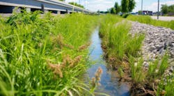
Hurricane Sandy removed more than 6 million cubic yards of sand from New York District’s coastal projects in New York and northern New Jersey. The district is replacing this sand and restoring previously built dunes and beach berms, as well as repairing other risk-reduction features like levees and tide gates.
Coastal restoration projects, including replacing lost sand, are important for the reduction of coastal storm risks in the future. A beach’s size, shape, and sand volume help determine how well the beach can reduce risk to a developed community during a storm. These elements offer a level of natural protection against hurricanes and coastal storms by absorbing and dissipating the energy of breaking waves and storm surges. The district is replacing the sand that was lost during Hurricane Sandy and is adding additional sand to restore beach projects to their originally constructed designs. This means the placement of even more sand than was lost due to Sandy.
The district is dredging 16 million cubic yards of sand from navigation inlets and offshore borrow areas and placing it on five coastal projects in New York and two in New Jersey. As of October 2013, the district had placed an estimated 4 million cubic yards of sand on beaches within its area of responsibility. The district recently completed sand-pumping operations in Coney Island and Rockaway Beach, with a second sand pumping contract scheduled to begin in January 2014, and is currently placing sand at Gilgo Beach. The district is also repairing a risk-reduction project in Oakwood Beach on Staten Island that involves a damaged levee and tide gate. Additional work on Fire Island West of Shinnecock Inlet and Westhampton will begin in 2014.
In New Jersey, the district recently completed the first of four sand pumping contracts for the Sea Bright to Manasquan Project and will begin work soon on its Keansburg Project. The Keansburg Project, which includes Keansburg, East Keansburg, and Laurence Harbor, will include sand replenishment and repairs to levees damaged by Sandy. All of this work is expected to be completed by summer 2014.
The Sea Bright to Manasquan Project was the world’s largest sand placement project by volume when it was initially constructed from 1994 to 2001. It involved the placement of roughly 20 million cubic yards of sand along roughly 18 miles of New Jersey beaches, reducing risks for multiple communities. The district is replacing 8 million cubic yards of sand throughout the project area, which would be enough material to build nearly six Empire State Buildings out of sand.
While some of the coastal restoration work started during the height of beach season, the district has gone to great lengths to mitigate the effect on recreation.
“The beaches weren’t closed,” says Anthony Ciorra, chief, coastal restoration and special projects branch, New York District. “We only closed off 1,000-foot sections of the beaches at a time to perform our work. Once a section was completed, we opened it up with a newly restored beach ready for the public’s enjoyment and moved to another portion. We couldn’t afford not to work because hurricane season is upon us. It’s a matter of public safety.”
Restoring Navigation
Many people are not aware of Sandy’s unseen impacts offshore, particularly to navigation channels throughout the region. As part of post-Sandy recovery efforts, the Army Corps is also restoring dozens of navigation channels and structures throughout the northeast that were affected by Sandy. This includes repairing breakwaters, jetties, bulkheads, and revetments, as well as dredging federal navigation channels altered as a result of Sandy.
New York District has already begun this work in its area, and it is all expected to be completed by spring 2015. To reduce costs and increase efficiency, the district is combining missions by using sand dredged from navigation channels to restore beach projects where feasible.
“We are using the sand that we are removing from the navigation channels and inlets to restore the beaches. So we are getting not only navigational benefits, but also beach benefits. Since we don’t have to send out a dredge specifically to gather sand to restore a beach, we are saving money that can be used for other Sandy projects,” says John Tavolaro, deputy chief, Operations Division, New York District.
Pre-Sandy Coastal Work Lessened the Blow
For years, the district has maintained coastal projects in New York and New Jersey, and although the massive storm overwhelmed most coastal risk-reduction projects, they still helped mitigate damages during the storm.
“Our projects are designed to reduce the level of damage from more frequent lower-intensity storms, but I do believe our coastal projects did minimize Sandy’s impact,” Ciorra says. “Areas that had our projects fared better than areas that didn’t. Even New Jersey Governor Chris Christie mentioned this. These projects didn’t totally eliminate damages, but definitely minimized them.”
New York City Mayor Michael Bloomberg agreed. His office stated that the Army Corps’ risk-reduction project at Plumb Beach along the Belt Parkway in southern Brooklyn likely prevented a breach of the adjacent highway, thus protecting a vital transportation link.
Work on the first phase of the Plumb Beach project, which included building a dune and beach berm to reduce risks to the highway, was done just before Sandy hit. Work on the second phase, which includes construction of groins and a breakwater to ensure the longer-term resiliency of the dune and beach berm, is ongoing and will be done by the end of 2013.
Westhampton along the south shore of Long Island, NY, was another area where a New York District project performed well during Sandy. Ciorra says, “In Westhampton where we had constructed a dune and berm, there was less damage to that community than in nearby areas that didn’t have any projects.”
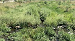
Even projects not necessarily designed to reduce risk, like the New York District’s restoration of marsh islands in Jamaica Bay, NY, may provide a blueprint for future approaches to coastal storm damage risk reduction.
“Marsh islands can act as a natural protective buffer to the mainland behind them during storms by absorbing wave energy,” says Lisa Baron, project manager, New York District.
Progressing on Coastal Projects and Studies
When Hurricane Sandy hit, New York District also had several projects authorized by Congress for construction, but not built. Some factors contributing to this included lack of federal or non-federal funding, lack of local support, or local opposition. The district also had several studies under way looking at coastal risk reduction for communities in New York and northern New Jersey.
After Sandy, and with funding from the Sandy Bill, New York District is working on coordinating with local partners and moving the unconstructed projects toward construction and advancing the ongoing studies while incorporating lessons learned from Sandy.
The Next Sandy?
The Sandy Bill called on the Army Corps’ regional North Atlantic Division to study ways to help reduce risk from storms to coastal communities throughout the northeastern United States.
The division has assembled a team of professionals from its district offices; federal, state, and local agencies; and academia to collaborate on the North Atlantic Coast Comprehensive Study.
The team is studying the 31,000 miles of coast from northern Virginia to Maine that falls under the division’s responsibility. The goal is to come up with a framework of strategies that can be used by agencies to protect coastal communities adversely affected by Sandy.
The team is studying 38 coastal areas to see how they can be better protected by using various measures, such as dunes, floodwalls, and bulkheads, to name just a few. Presently, the team is considering almost 30 different risk-management measures, including some of the strategies proposed by the City of New York in its recently published report from its Special Initiative for Rebuilding and Resiliency.
“We are trying to place the right combination of measures in the right coastal locations based on the area’s infrastructure, population, and social and environmental vulnerabilities,” says Lynn Bocamazo, engineering division, New York District, who is on the team.
Donald E. Cresitello, planning division, New York District, who is also on the team, says, “There is a lot of interest in this study, especially from communities severely impacted by Sandy that have no federal projects or studies in their area. They want to be assured they are going to be included in the study and have some risk reduction from future storms. This study looks at those areas.”
Ciorra, who is not on the team, adds, “Most of our projects are designed to reduce the level of damage from more frequent lower-intensity storms. The study may look at storms like Sandy that may become more frequent in the future. Because of this, the team may have to develop a more robust plan for these projects, because the storm that we estimated as being a 500-year storm event may now be a 100-year storm event.” A 100-year storm event is a storm that has a 1% chance of occurring in any given year.
The team is doing this; the strategies it is developing will look to reduce the risk from a 100-year storm event, and it is adding 3 feet of stormwater to account for the potential of 100 years of sea level rise.
“What’s going to be beneficial from this study is that it will provide agencies valuable information they can use to save time and resources on future studies. The environmental and economic analysis and models that will come from this study will already be prepared for others to benefit from,” says Bocamazo.
The study will be completed in January 2015. A draft of the study will be available to the public for review and comment this winter. To view the draft and receive regular study updates, please visit http://www.nad.usace.army.mil/CompStudy.
Ultimately, the public will benefit from the study. The Brooklyn resident who took part in the annual Mermaid Parade at Coney Island this summer says she is proud to call Coney Island her beach. She notes that it is very important the public has a place to swim and enjoy the water, and she loves that there is a place for the city people-and mermaids!-to touch the sea.
Ciorra says, “Next summer, people are going to be very surprised at how significantly their beaches are going to change. They are going to be much bigger and wider. This work is going to be challenging and exciting. It’s a unique opportunity the Army Corps has been given. We are going to be expected to deliver.”
To learn more about the post-Hurricane Sandy work the Army Corps’ New York District is performing, visit http://www.nan.usace.army.mil/Sandy.