Airplane Safety and Aquatic Protection
Any work taking place in and around Boston Harbor attracts a lot of attention from local, state, and federal agencies. As a result, when the Massachusetts Port Authority (Massport) came to the realization that runway safety area work at Boston’s Logan International Airport was necessary to meet required guidelines by 2015, it began discussion with federal authorities as early as 2007.
Construction costs have exceeded $80 million and have involved some innovative solutions.
Logan Airport sticks out into Boston Harbor, and it was necessary to extend the length of one of the airport’s runways, but the existing runway ended pretty much at the water’s edge. Building a standard runway deck into the harbor would have required massive amounts of backfill, damaging the sensitive aquatic environment.
“Over the past 20 years, there has been a huge push to clean up the harbor,” says Derek Hanson, site superintendent with McCourt Construction. “The goal was to turn it from a pretty polluted, pretty industrial setting to relatively clean water. Now it’s gone to the point of actually being very clean water.”
So instead of a standard runway deck filling up part of the harbor, a pile-supported deck was built.
Hanson’s company is involved with overhauling the runway safety area on one of the runways at the airport. As he explains it, there are actually two portions to it.
“One is the EMAS bed—the Engineered Material Arresting System, which is designed to stop an airplane that overshoots the runway. The first portion of the project was to replace the existing EMAS bed, which reached the end of its expected lifespan.
“The second portion was to work with the area that extends beyond the runway, beyond this EMAS bed. There was a marshy, grassy area that tapered off into an extension of Boston Harbor between the shores of East Boston, where the airport is, and Windsor, MA.
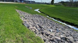
“We were installing off the end of this EMAS bed and down into the water. It’s referred to as an incline safety area. It’s the same premise as a runaway truck ramp—it’s made out of crushed stone and has a tapered surface that’s been graded to a certain slope. This transitions from solid ground down into the water itself.”
Because of the sensitive environment of Boston Harbor, Massport was insistent on minimizing silt and sediment movement during the extensive runway safety area work.
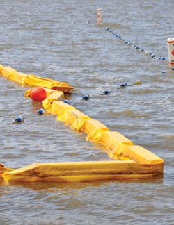
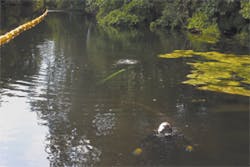
“As part of the permitting process, Massport committed to a double turbidity curtain,” says Hanson. “So that’s what we put in. We have a double line of turbidity curtains set up. The area we’re transitioning into the water is about 500 feet wide, and it extends on average about 150 feet into the water, from the high tide line down to the average low tide line.
“This is an average. It’s more at the sides—it’s almost 200 feet. But at the very center of the area, it may only be 100 feet or so. The average tide drop in this area is about 10 to 10.5 feet, so the water level drops considerably, and it goes out a long way.
“Every 12.5 hours or so we make a full cycle, from low tide all the way back up to high tide. The inner curtain is 800 feet long, and it transitions from landside, where it is anchored, over a length of 150 feet, from zero feet deep to 10 feet deep. What would be the front edge, where it is 10 feet deep, turns and over the course of 150 feet again transitions back from 10 feet deep to zero.
“We’re encompassing the end of the area, the end of the runway, in a three-sided pattern. The outer barrier is 850 feet long. Across the outer end, there’s an additional 50 feet of that 10-foot-deep curtain.”
Hanson notes that by design, there is considerable movement of the turbidity curtains.
“This system has an encapsulated float at the top, so it travels up and down with the tide. As the tide goes out, the turbidity barrier is more or less sitting on the ground. Then when the tide comes back up, the turbidity curtain rises up and actually, at high tide, the curtain pulls away from the bottom of the water by about a foot.
“The idea of that is that any silt that has accumulated on the turbidity curtain itself gets washed off. Otherwise, the turbidity curtain would get weighed down by the amount of silt that is being captured on it. Eventually it would sink and not return to the top. So every 12 hours, basically it washes itself and returns to a relatively clean condition.”
Hanson reports that this double turbidity curtain has worked nearly to perfection.
“Now that we have this thing set up, we’ve never seen any turbidity migrate outside of that inner curtain. The outer curtain has really been there as a backup. It’s been an effective system.
“You can see the silt in the water, and we don’t really get anything migrating outside of this curtain. It contains everything. When the tide then goes out, that sediment settles back down to the ground, and when the tide water comes back in, the water is basically back to being clean again.”
One of the issues that has come up is that in the tidal environment, the water and the curtains are changing direction; they’re being moved up and down, and pulled in and out, so there is a lot of tugging on the barrier.
“We’ve had to relocate the barrier curtains a couple of times,” explains Hanson. “We have to get out there in a boat and tug it back in, because it collects and filters so much water that it acts as a big sail in the tide. Spilldam Environmental, manufacturer of the curtains, has been fantastic to deal with. We consulted with them about this issue.”
He notes that the curtains are secured by 40 anchors and also with concrete blocks, similar to traffic barriers. “But even with all those anchorage points, it continues to pull itself all around. So we’ve had to adjust the location of this several times. The wave action and the force of the tide water moving in and out keep moving the turbidity curtains all over the place. So we’ve had to relocate this barrier several times.”
Because of the heavy equipment being used on the job, Hanson has had to be cautious about equipment fueling and the location of his vehicles.
“We had to establish a 100-foot buffer zone, which is 100 feet back from the high-water mark. Any equipment that isn’t being used—pickup trucks, delivery vehicles, and so on—has to be parked outside that 100-foot buffer area. We’re not allowed to leave any equipment within that zone.”
A variety of other BMPs were also employed at the work site.
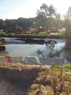
“We’ve had silt fence, and we’ve used hay bales and straw wattles. These encompass the entire perimeter of the job, including our equipment storage area outside that 100-foot buffer. We also have two catch basins in the area, drainage points that are outside of our turbidity curtain, and those are protected with silt fence.”
Hanson spoke highly of his turbidity curtain supplier, Spilldam Environmental. “They are a local company, and the owner of the company has done work at Logan Airport before, so he was familiar with the airport. Because of their location, they were able to deliver quickly. We had this curtain custom made, and we had it within two weeks of our order.
“The product is a Cadillac of turbidity curtains as far as this work is concerned. We’re very impressed with how well it is made, how quickly they were able to get it delivered to us, and, most importantly, how effective it is. You wouldn’t think that this curtain hanging down would have that effect, but it is nearly 100% effective.”
Another group that is especially pleased with the project is the local seagull population.
“We have found that it is trapping all kinds of small crabs inside the curtain,” says Hanson. “As they try to migrate out, they get caught up in the curtain, so the seagulls have a feast every day when the water drops down, because now they have all these crabs trapped on the surface. It’s been detrimental to the crab population in this local area, but the seagulls are having a field day. They love it.”
Placing Gas Transmission Lines Under the DuPage River
In the summer of 2014, Midwestern Contractors was involved with laying two high-pressure gas transmission lines across the DuPage River, located in the western suburbs of Chicago.
“In this project, we had to lay two 18- or 20-inch lines across the river,” explains Mike Purpura, the company’s director of business development. “To do this, we had to control the surface water. And before that, we had to bring the pipe to the edge of the river.
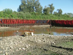
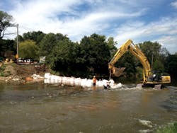
“We established coffer dams out into the river to temporarily control the flow of water into the area that we would ultimately excavate. The coffer dams were set almost as a set of brackets, with the open end of the brackets connecting into the shore, and the outer, long edge of the bracket parallel with the flow of the river.
“Once that was established, we used pumps to dewater the inside of this bracketed area. Once it was dewatered, we used an excavator to go in and expose a trench for the pipe, to get the pipe down to a suitable depth. You don’t want the pipe too shallow, where someone can drop something on the pipe and damage it. So it might be five or six feet below the bed of the river.
“We then fabricated the pipe and laid it into this trench. We welded it to its adjoining piece that was protruding from the shore. This area was then backfilled, the bottom profile was re-established, and the coffer dam was removed.
“The ‘bracket’ then essentially flipped, with the open end now facing the opposite side of the river. The same process was then used on this opposite side, the only difference being that the first piece of pipe protruded into the new dewatered coffer dam area, so when we excavated, we had the stub of the first piece sticking into the excavation.
“We laid the new pipe in, made a weld out into the river, and then made a weld onto the shore, so we had a unified piece of pipe going all the way under the river.”
Crews did the process twice, for two pieces of pipe, using the same coffer dam method. “I’m making it sound easy,” says Purpura, “but in the process there was a lot of sandbagging, adjusting, sealing, and pumping, with 24-hour-a-day work because once the pumps are actually started, you can’t shut them off. So we had to go into shift work to make this whole thing happen.
“In addition, we had traffic to control. There is a road that parallels the river, not too far away from it. We had to keep the traffic flowing while we were moving excavated spoils across this road, both during the excavation, when we were taking spoils out, and then when we were putting spoils back in. They all had to be moved back and forth across this road, and down to where the backhoe could get at them and use them to backfill the excavation.”
Two gas transmission lines were placed across the DuPage River near Chicago.
The “spoils” consisted of dirt, rocks, and mud excavated out of the river. It had to be stored temporarily until the pipe was in place. The pipe was first covered with sand, to protect it, and then the native spoils were returned to the riverbed.
The coffer dams were created on the 130-foot-wide river from a series of bladder dams from Dam-It Dams. “They were about 22 to 25 feet wide and 8 feet tall when they were filled with water,” says Purpura.
“The project didn’t require water filtration. But it did require that we minimize the turbidity by taking whatever water was coming into the excavation, and if it was clean, pumping it out. If it was dirty, then we had to route it through a filter bag and hay bales. We also had silt fences and some geotextile fabric. We didn’t do anything really exotic there. The most exotic thing we did, I suppose, was filling up these bladder dams to
control the surface water of that river, so we could excavate.
“Once we excavated and moved the spoils out, we were more or less in a contained area, with everything contained with silt fencing. So any runoff from our spoil piles—and we did get some heavy rain—would be caught by the silt fencing.”
Purpura notes crews were careful not to do any undue damage to the area.
“Obviously, when you get construction equipment in there, it kind of tears things up. We used crane mats for our access roads, so we had vehicles traveling on crane mats. In those areas immediately around where this work was taking place, on the shore, we had silt fencing and various erosion control methods set up to control anything that might wash off from our activities on the shore.
“The crane mats are 8 inches thick, 16 feet long, and 4 feet wide. We had to lay a series of those, for over a quarter-mile, making a road out of timbers, essentially. This got us inside our silt fence work area and enabled us to get materials and vehicles in and out without doing any permanent damage to the area. It killed the grass, but with a little reseeding and straw, we can bring all that back pretty quickly.
“On the river bottom, we were limited to working within a fairly confined right of way. We had to stay within about 50 or 60 feet to minimize disturbance of the river bottom.”
Cleanup of Chassahowitzka River in Citrus County, FL
Clearing Away Sediment and Cultural Artifacts
The Chassahowitzka River in southwest Florida is fed by a dozen springs and has been labeled one of the most ecologically healthy waterways in the region. However, significant amounts of sand and organic material have entered the system from residential canals and stormwater runoff.
“There has been a lot of fertilizer going into the ground, producing nutrient-rich water,” says Graham Cofer,
commercial diving manager with Underwater Engineering Services. “This clogged things up, and organics developed on the river bottom. It was nasty.
“For 20 or 30 years, algae was growing in the springs, and there was decreased output because of the water table being lower for awhile in Florida. So there was less flow, and it wasn’t getting flushed out.” Underwater Engineering Services was involved in a restoration project.
An interesting facet of the project is that hand-dredging was required to clean out the springs because of the wealth of cultural artifacts found in the river. Although much trash was dug out, there were also some artifacts dating back thousands of years.
Among the more interesting items found were Native American tools and paddles, 16th century Spanish pottery, and arrowheads. In total, some 3,800 cubic yards of sediment and more than 10,000 artifacts have been pulled from the river, according to Cofer.
“There are a lot of beer bottles, a lot of whiskey bottles, a variety of things. We had an archaeological company working with us to classify all of this stuff. We have found anchors, ancient spear points. It’s been catalogued, at great expense.”
Cofer explains that the project involved construction of a coffer dam berm, on top of which sat 10 geotubes. A sand and water mixture was pumped from the springs into these bags.
Chassahowitzka River cleanup process
“The water passes into the bag, which works like a big filter, collecting the sediment that was dredged from the headspring,” he says. “Clear water then filters out, leaving the sediment in the bags. We hauled them off after the bags were filled with the dredged material.”
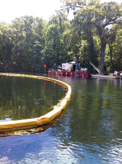
The project took place from March to August 2013, and the job specifications from the Southwest Florida Water Management District included guidelines that the nearby boat ramp remain open during the entire procedure. As a result, Cofer notes, crews also installed approximately 1,000 linear feet of turbidity curtains. This allowed work to proceed without undue silt and sediment movement from nearby boat wakes.
The hand dredging not only cleared the area of tons of sediment, but also deepened the project area by approximately 2–4 feet.
From a Hole in the Ground to Something Grand
On the banks of the North Saskatchewan River in Edmonton, Canada, a private club was looking to build a new boat ramp.
Myles Zuk, owner of Horizon Cleaning, explains that the group had previously simply carved out an area in the ground, but it wasn’t very effective for them.
Coffer dam in place on the DuPage River in Illinois
“To build what they wanted, we needed to go about 20 yards or so into the river itself, so we created a U-shaped dam around the area and dewatered the work space. We used a coffer dam, a bladder dam, from Dam-It Dams. With this system, you essentially fill the dam with water, and this creates the barrier. You then dewater the side you need to work in.
“Once we dewatered the area, we had to excavate about a yard down. In that void, we put 80-centimeter riprap. So we excavated almost a full meter down into the riverbed and surrounded our platform with heavy, heavy riprap. This holds the ramp pieces in place.
“The riprap held it in, but there was also a gravel surface that we created, and that was topped with precast, ribbed concrete planks. Each rib is about an inch and a half wide. This helped with grip, similar to what might be placed on a slippery roadway.”
The bladder dams were 4 feet high, and extended for a length of 250 feet. When filled with water, the bottom of the dam swelled to 10–12 feet wide.
“It will expand about two and a half times its height,” says Zuk, “so if you have a four-foot dam, then at its base, it’s 10 to 12 feet across. It’s like a big sausage. As it fills up, it goes high and wide.
“They’re looking for stability with this design, so it’s not just the height; you’re looking for something that’s not going to move.
He notes that he chose Dam-It Dams’ product because “what they wanted here was a fully synthetic product. It had to be non-earthen, to reduce sediment. The fact that it was to be a bladder dam was specified.
“One of the things about this system is that the river bed itself dictates how well you do. What I mean by that is that our conditions were very porous, so it wasn’t a muddy, silty bottom; it was a very coarse, gravel bottom. As a result, what we experienced was some penetration from underneath the dam. The fellows at Dam-It gave us some good ideas about how to mitigate that, and we were successful.”
In addition to the bladder dams protecting the river, there was also silt fence placed along disturbed areas of the riverbanks.
Zuk adds that another consideration was the aquatic life in the area. “There are more than 20 species of fish in the river, so there was concern about disturbing their spawning beds. The timing of the project involved two considerations to minimize impact to the fish. One was determining which fish were doing their thing at what time, and the other was to schedule the project while the river’s water level was at a low point, so it was arranged for October.”
The bulk of the work was completed within a couple months, before the end of 2014. The only work left was the landscaping, which had to wait for the then-present frost to thaw.
How does Zuk describe the transformation of this boat launch from its original carved-out area of ground?
“Now, it’s almost Olympic-style. If anything, it’s overdone!”
