Monitoring the quality and quantity of stormwater is an essential part of good stormwater management. Accurate monitoring equipment can more than pay for itself as the data it collects leads to wiser decisions and better use of financial resources and employees.
Ormond Beach, FL
The city of Ormond Beach is on Florida’s Atlantic Coast, about 6 miles north of Daytona Beach. Its current population is about 44,000. One of Ormond Beach’s most attractive features for residents and visitors is its interconnected lake system within a large city park. The three major and two smaller lakes are interconnected by tributaries and swales. The largest lakes range from about 350 to 500 yards across.
“People like to go from lake to lake by kayak. Ormond Beach is known for our park system and athletic fields. The city has a huge commitment to the public for recreation,” explains Kevin Gray, operations manager for Ormond Beach’s Public Works Department.
Besides providing water recreation activities, the lake system plays a critical role in protecting the residents of Ormond Beach and their property from flood damage. The other essential component in that protection is the city’s OptiNimbus CMAC (Continuous Monitoring and Adaptive Control) system from OptiRTC of Boston, MA.
The catalyst for all of this was a storm event that hit Ormond Beach in 2009. The storm caused severe flooding and property damage to 79 structures. Several roads in the Laurel Creek watershed became impassable.
“In Florida, when you buy property by the water it’s beautiful, but it becomes a nuisance when it encroaches on your house,” notes Gray.
With the massive property damage from the unnamed storm of 2009, Gray and other public officials in Ormond Beach knew they had to make some significant changes to prevent such severe flooding in the future. They considered a number of options. Fortunately, the lakes were already interconnected. The swales were already on city property. Getting easements from property owners required some time and effort.
Gray says that the OptiNimbus monitoring system is “very cost-effective in comparison to building retention basins or the city buying homes in the flood zone. We could have done those things instead.”
After the new system was installed, “once one rain event came and nothing [bad] happened, it paid for itself,” he adds.
The monitoring system “works flawlessly and it’s very easy to use. It monitors the weather. Prior to a rain event, if three inches of rain are expected, the system draws down three inches of water from the lakes. We can pump up to a million gallons of water an hour.”
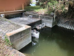
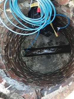
The pumps at the Laurel Creek Pump Station are underground in two vaults. Each vault measures about 12 feet by 12 feet. The pumps run alternately, in cycles of three to four hours. Powered by electricity, they are tested monthly to be sure they are working properly.
“There are monitors at six different locations—two in each of the three major lakes, at the north and south ends of each lake,” explains Gray. “The monitors track weather, storage capacity, pump run time, water levels, and lake flow by the hour.”
The department has many failsafe measures built in, including some from other companies besides Opti. A pager alerts a city electrician to any malfunctions.
“We put in a Tradewinds generator [from Tradewinds Power Corp. of Miami, FL] with an automatic switch. It’s diesel and holds 35,000 gallons of fuel in two storage tanks. It has a run time of almost a week,” says Gray. “During [hurricanes] Matthew and Irma it worked perfectly.”
Gray admits, “Matthew and Irma really put us to the test, but we didn’t have to worry about the Laurel Creek basin [flooding]. Our engineering staff did their homework and got it right the first time. It was a team effort with everyone involved.”
Before Hurricane Irma hit in 2017, the OptiNimbus CMAC discharged approximately 70 acre-feet of stored water from the lake system. Even with the pumps working, Irma’s winds and rain added about 190 acre-feet of water for storage. Since local flooding occurs at a storage volume of 250 acre-feet, the pre-event drawdown was very effective at preventing flooding and damage. Without pre-event drawdown, the lake elevation would have exceeded the flood stage of 5 feet (i.e., a volume of 250 acre-feet).
Data are collected by the monitoring system before, during, and after a storm event. Gray says that with this much detailed information, “We’re getting close to National Hurricane Center results, and people from other cities have come to look at our system.”
Summing up what the OptiNimbus system has done for Ormond Beach, Gray says, “We’ve eliminated 95-plus percent of area flooding in the Laurel Creek low-lying areas. We’ve essentially dried up the area.”
Besides the reliability and accuracy of the system, Gray is pleased with the convenience it offers. “I can turn the pumps on and off from my office,” he notes.
Alligators getting into the system have not been a problem because the intakes have gator guards. The alligators generally don’t come that far inland, but turtles are a different matter.
“All of the lakes have a decent turtle population, and we have grass carp for weed control,” Gray says. “We have a screening system on all of the intakes so that 95 to 98% of the fish, rodents, turtles that would go through can’t.”
The OptiNimbus system has functioned so well for Ormond Beach that when two other pump stations are added in early 2021, the OptiCumulus system will be installed. The OptiCumulus is also cloud-based. It adds to the OptiNimbus installations by integrating additional onsite sensors and measurement devices, allowing for even more rapid environmental monitoring and analysis.
While Ormond Beach is fortunate to avoid the problems that can come with a combined sewer system, Gray says that the city does have some older infrastructure in its 70,000 linear feet of stormwater system. And with Florida’s tropical climate and plenty of rainfall, vegetation thrives. To keep it under control, the city spends $100,000 annually mowing and reshaping ditches and swales. Gray says it takes the Public Works two years to get all of them done, then the cycle begins again.
Monitoring the Flow
When Chris Davis named his Dayton, OH-based monitoring installation company Lower 48 Instruments, he didn’t realize how large the firm would become. Now he and his staff have clients all over the world.
“Most of our customers are municipalities or engineering firms working for municipalities,” says Davis.
Using scientific instruments to collect data that are then analyzed to solve problems is a natural fit for Davis. “I’m a numbers guy,” he admits.
To serve these customers, Davis often relies on monitoring systems from In-Situ Inc. The firm is located in Fort Collins, CO.
“We use their products a lot. They’re very adaptive,” he says.
One project on which Davis has installed In-Situ monitors is a study of the water collection system in several counties in northern Ohio.
“We’re trying to isolate stormwater from the collection system,” he explains. “The sewer lines are mostly separated, but they are carrying more volume than expected. They’re receiving a lot of infiltration from the storm sewers. We want to find out why. There’s still a lot of old line left—is the old infrastructure breaking down?”
Davis notes that spikes of the unexpected volume directly correlate to rain events, but exactly where the water is entering the system has yet to be determined. That’s what the In-Situ monitors will be able to pinpoint when engineers look at enough of the data they have collected.
One unusual factor that may be causing part of the problem is that the pipes vary a great deal in size. They range from 6 inches in diameter up to 30 inches in diameter.
For this project Davis is using two types of monitors from In-Situ. They are the HV Flow and HV FlowPro models. The data these monitors collect will be compared with that from rain gauges.
“They’re designed to drop in and monitor underwater,” he says. And even though the pipes vary so much in size, the In-Situ meters will work perfectly. “This meter can go from [working in] very small pipes to those 10 feet in diameter.”
The data collected by the flow monitors is sent to a server that In-Situ maintains. The client can log in and download the results whenever he or she wishes.
Davis says that In-Situ’s MACE monitors are reliable and accurate, as long as the durable case remains intact to protect the sensor. “I have some in my rental fleet as old as seven years. They’ve been used on a ridiculous number of jobs.”
He adds, “They’re not cheap, especially in velocity applications,but they understand the physics behind velocity.”
When a pipe or a stream is not completely filled with water, it actually has three different speeds of water within it. They are for the flow on both sides, for the center, and for the surface of the water.
Davis explains that the MACE meter’s sensor is capable of taking readings at these locations with different flow speeds. Then, it averages them to “give you an incredibly accurate picture of how fast the water is moving.”
Acknowledging that laser meters are good choices in some applications, Davis notes that the laser doesn’t have the same Doppler technology to apply when accurate velocity is needed.
“A laser is only capable of reading a small part of the stream. It is limited to the small cross section of the pipe. If the pipe is rough or has gravel in it, the laser reading is not accurate. But the MACE’s sensor will recognize the gravel and compensate for it in its reading.”
Technology for this averaging of flow speeds in different sections of the pipe or stream was developed in Australia. Davis says that In-Situ offers it at the same price or cheaper.
This multi-county project is set up to collect data for 60 days. Davis says that should be a long enough interval to provide useful data so that the problem can be solved. At least a couple of rain events will occur within that interval, possibly more.
Lower 48 Instruments is also working on a monitoring project for a US military base. The company is monitoring permitted outfalls.
“We have to monitor the stormwater outfalls to test for chemicals that are used at the military base,” explains Davis. “We monitor for both water quality and flow.”
To do the monitoring, Davis’s crew installed In-Situ’s Flow Pro E. “It does both [types of monitoring simultaneously]. It has an input card and an output card. Each card allows you to connect another sensor.”
Depending on the combination, approximately six can be connected, Davis says. An alternative is “integrating an SDI 12, which has much greater capacity than an analog card.”
“We use the same sampling that the EPA prefers. It’s a vacuum style sampler, made by Aquamatic, from the UK [Manchester, England],” says Davis, noting that the EPA has preferred vacuum technology as far back as the 1970s.
“We use vacuum samplers because they don’t clog the way a peristaltic sampler can,” he explains. “I want to get the best sample I can.”
Davis says that this monitoring project at the military base will go on for years. “We started two and a half years ago because the prior monitoring wasn’t working. They had to [resort to] hand-sampling, which is never as accurate. Hand-sampling is a random, one-time figure. Metering is much more accurate because it is a series of small samples. “
Davis notes that site conditions on a project can vary and there might also be other problems, “but if the metering isn’t accurate, you really don’t have a clear picture of the situation.”
The In-Situ monitors are now transmitting data about runoff from five stormwater outfalls at the military base. When the work began, the Lower 48 Instruments crew installed monitors on 14 outfalls.
“After the EPA got the results, they reduced the number of monitors because the data was so good,” says Davis.
Davis likes In-Situ’s MACE flow meters for their versatility. “They’re user-friendly. You can change them remotely. They can measure multiple things at different intervals. They’re time and date-stamped all the way down to every 30 seconds. Each site can have its own profile.”
Regulation by local, state, and federal agencies has been increasing in virtually all areas of stormwater management for some years. Davis acknowledges that most of his clients are highly regulated. For that reason, they value monitoring, and “They want the best data they can get, or they risk not getting data that the regulatory agencies want,” he says.
Thurston County, WA
Thurston County includes the state of Washington’s capital city, Olympia. Located at the south end of Puget Sound, the 770-square-mile county has a population of more than 250,000 residents and it gets an average annual rainfall of more than 50 inches.
The Thurston County Water Resources Environmental Monitoring Program (EMP) is responsible for installing, maintaining, and collecting data from fully functional monitoring stations placed throughout the county. These stations monitor atmospheric conditions, stream flow, and groundwater and lake levels.
These monitoring stations form the two separate monitoring programs conducted by Thurston County. About one-quarter of these monitoring stations are part of an inter-local monitoring agreement (ILMA) between Thurston County and the cities of Lacey, Tumwater, and Olympia.
ILMA monitoring began in the early 1990s. The data are used to gage the condition of water resources in the northern part of Thurston County and within the jurisdictions of the three cities.
Thurston County also maintains a larger program called the general environmental monitoring (GEM) program. This concurrent program, started in 2000, contains the majority of the stations that are deployed throughout Thurston County. The purpose of the GEM program is to evaluate all aspects of the water cycle countywide. That evaluation includes atmospheric conditions, stream flow stages and volumes, and groundwater and lake levels.
“In Western Washington, most municipal stormwater permittees pay into a fund to handle monitoring,” explains Nat Kale, water resources specialist for Thurston County. “This stormwater action monitoring program (SAM) is administered by the state of Washington’s Department of Ecology.”
Kale adds that in Thurston County, “we do monitoring for the board of county commissioners. They’re very interested in water quality. We also sometimes monitor specific projects, such as a site that discharges to a very sensitive stream or discharges directly to Puget Sound.”
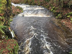
An example of that is the woodland stream with direct discharge. It has an Isco Flow monitor to collect data for the total maximum daily load (TMDL).
He notes, “There are two big drivers for this kind of monitoring. One is marine shellfish. We have a lot of commercial and recreational fishing that is affected by pollution. The other driver is [protecting] salmon.”
Where the salmon are a matter of concern, “we monitor for water quality, flow, temperature, turbidity,” he adds.
Kale says that in terms of increased regulation driving more stormwater monitoring, “I’ve noticed a number of interested parties, so interest does seem to go up. We probably work more with the state—the Washington Department of Ecology is involved with enforcing the Clean Water Act—but also the Department of Health, for drinking water and shellfish [safety].”
He also notes, “A lot of people are getting more interested in what data are available and how they can use the information.”
Kale says that monitoring for illicit discharges “doesn’t have a break between stormwater and non-stormwater issues. They are both an urban and a rural issue, even though our permit only covers our Urban Growth Area.”
He recalls a stream that showed significant spikes in bacteria. “There are multiple shellfish areas there. Through our Pollution Identification and Control program, our team took samples upstream and followed the stream to a campground.” The campground, which originally was intended to be only a temporary installation, had turned into permanent residences. There was no oversight over septic tanks, so the pollution eventually reached the stream.
“We’re in a constant state of trying new monitoring and metering instruments,” explains Kale.
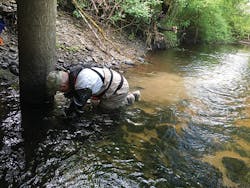
For other monitoring, Kale says that Thurston County’s staff members use SonTek FlowTrackers in low streams. “We wade out into the streams to place them. They’re good, but we only have two because they are expensive.”
Of the Onset U20 automatic level meters, he says “We have maybe 50 of them. They’re suspended in streams or wells and take automatic readings every 15 minutes.”
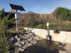
Kale says, “We’re looking into [getting more] meters from Campbell Scientific to deploy and leave. They’re battery powered and completely enclosed. We’ve had them last for longer than [the expected] five years.”
He notes that the monitoring instruments from Campbell are “complicated to get running, but the best telemetry system we’ve found. You can do more with them. Some protocols allow for multiple sensors together. With the Campbell 300 SDI 12, you can string together dozens of sensors.”
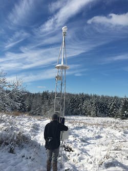
Thurston County has upgraded to a Campbell Scientific CR300 data logger. “It is connected to any number of instruments. They power a few of our weather stations and also a small number of stream gauges.”
Kale sees two needs for future monitoring. “The first one is cheaper telemetry. Now, it is expensive and complicated to set up. The cost needs to go down and the reliability needs to go up. If you could use an outside cell phone, the data could go through a satellite, and that would be cheaper.”
The second need Kale sees is for “more automatic sensors for water quality, for monitoring levels of phosphorus and nitrogen at 15-minute intervals, and easily set up. That would be highly beneficial.”
In the future Kale would love to see automatic sensors to monitor water levels of metals, copper, and contaminants such as polychlorinated biphenyls (PCB) and polycyclic aromatic hydrocarbons (PAH). “Recent research at Washington State University is looking into whether PAHs in stormwater may kill fish,” he says.
“Our overarching reason for monitoring is that when we have our own data to access, it empowers us to make better decisions. If we have a lot of high-quality data, we are in a power position to influence the decisions others make, too.”
Seeing a conundrum, he says, “We can always use more data. The challenge is how to distill that data in a meaningful way for hydrologists, engineers, and others.”